Posts

Showing posts with the label google earth

Where2.0 am I ?

Image
This past week at Lat 37.329304, Lon -121.89051, I got the opportunity to attend my first Tim O'Reilly's Where2.0 Conference. 'Now in its sixth year, the Where 2.0 Conference is where the grassroots and leading edge developers building location-aware technology intersect with the businesses and entrepreneurs seeking out location apps, platforms, and hardware to gain a competitive edge. In the O'Reilly conference tradition, Where 2.0 presents leading trends rather than chasing them. At Where 2.0, you 'll find source mapping tools, reality mining, open standards for data and location web services, and sensors for obtaining location data. We'll learn how the established geo industry is reacting to the first businesses making money from their grassroots geospatial projects. There's no better place to meet the people behind the mashups , the people behind the platforms, and the people looking ahead to the future of geospatial . Join us at Where 2.0 to debate...

A glance @ '09 and a look ahead.

Image
So it's 2010! The '00s are over and one doesn't need to be a historian from the future to see the Web has changed humanity and the world in the past decade in a way we are still trying to understand. There is a whole generation now that only knows life with the Internet, web2.0 is evolving, social networks are the new digital countries, cyber life to a growing number is as important as the real, and ignorance has become an option as people are able to connect, share, and access information about anything at the click of a button. For ten years I have experienced technology ever increasing in our daily routines and watched 3D on the Web become more common place with multi-user environments, games, digital globes, and more. Google Earth, Second Life, World of Warcraft, and the like have made this an exciting past decade of web3D and other mixed reality technologies for sure. To keep this post short, let's look at some of the highlights from the previous year. Augmented Re...

Tis the Season....!

Image
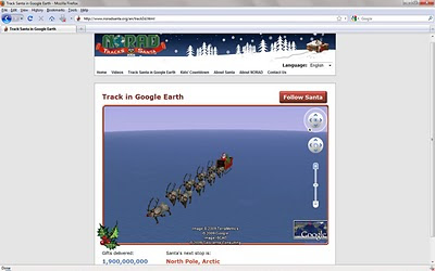
Happy Holidays and best wishes in the New Year! Now back to tracking Santa on Google Earth!

When in Rome... support your 3D web standards

Image
I came across these two examples on how Humanities, Art, and Natural Sciences are adopting 3D web open standard technology for preserving and sharing cultural heritage in Rome. 1. Rome Reborn - Rome Reborn is an international initiative whose goal is the creation of 3D digital models illustrating the urban development of ancient Rome from the first settlement in the late Bronze Age (ca. 1000 B.C.) to the depopulation of the city in the early Middle Ages (ca. A.D. 550). Starting on June 11, 2007, when the model of ancient Rome was first shown publicly at a ceremony in Rome, a number of video fly- thru and static images of the model were posted for free public viewing online. In August, 2008, the alpha version of Rome Reborn 2.0 was demonstrated at SIGGRAPH held at the Los Angeles Convention Center. In November, 2008, the latest version of Rome Reborn 1.0 was published to the Internet in Google Earth. On 12 November 2008, Michael Jones ( CTO of Google Earth) in partnership with Joel...

Planet 9 zaps planet Earth with mixed reality Raygun

Image
Founded in 1991, Planet 9 was one of the Internets' first 3D content providers. Their mission is "building the next generation of data and software to bring 3D city interfaces to applications." Led by architect turned 3D web CEO David Colleen, Planet 9 is a long time leader in digital city creation and cutting edge applications. Planet 9's latest innovation is RayGun ™. RayGun is the first application to provide what David calls "Social Navigation". I got the chance to meet with David Colleen to ask him some questions about this first 2D and 3D geo -aware social network. Originally developed for Boeing and the US Army, RayGun combines the technologies of GPS tracking, route finding, friend finding and social networking functions all within a state of the art 3D interface. Users and their friends are shown in their correct locations so that they can share routes, text chat, share photos and videos or use our new push-to-talk feature. The first mobile mix...